Knowledge Centre- Subject Index Main Help page |
Map dates
Dates on the maps in this collection are a major problem.
Generally, maps that have detail that should be regularly updated show two dates, that of the base map that depicts the topography and an over print date of information such as trenches often printed much later, sometimes a year or more later.
The base map date format is often the month and year or just the year. The date the overprint itself was made is never recorded but the date the information is corrected to is often shown as "Trenches corrected to d/m/y" but this is not always the case. In this collection, if the map does not state explicitly a corrected date, the "correct to" date was taken from the last date visible on the map; that may be hand written. It is never assumed. Any data of any kind in this collection that is assumed has been shown in [square brackets] and therefore cannot be relied upon as primary evidence.
The big problem is that many maps have either no over print date or no date at all. It is important to realise that if a map shows just the base map date, that date bears no relation to the date of any overprinted data even if it is tempting to think it does. It may be possible to date the overprint by correlating unit movements from official histories or war dairies. There are even examples in the collection of an overprint date being before the base map date; the reason for this has not been discovered.
This date situation makes searching for maps harder, a simple search by date might yield relevant results but the lack of such results does not imply there is nothing to be found, simply that searches by place, sheet number or scale will have to be tried. If you don't find a map by date, keep trying!
The situation also means that if topography is depicted, it may not have actually existed at the time. Although a few maps show areas as "destroyed by shell fire", most do not. This example of a map showing Passchendaele provides a good example. The church is clearly visible as are other topographical features but the base map is dated 28th November 1917, after the official end of Third Ypres - the Battle of Passchendaele - by which time the whole village was destroyed. It also shows arcs of artillery fire, hand drawn, implying the difficulty of providing official maps in time. It was produced by a Field Service Company not the Ordnance Survey and is marked "Trenches corrected to 24/10/1917", i.e. earlier than the base map.
Great care must be taken with dates on maps.
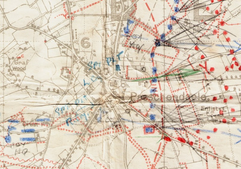
Map is dated 28th November 1917
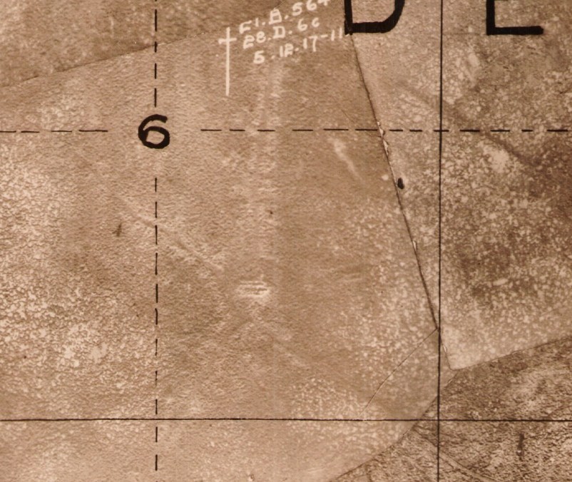
The same area a week later but the damage was done before this photograph
was taken. The outline of the church is clearly visible but it cannot be claimed
it still existed.
Knowledge Version 2 1.1