Knowledge Centre- Subject Index Main Help page |
What can be found on the Western Front from LiDAR images?
Although LiDAR can be a complex subject if looked at in depth, the use of freely available images to see changes in the ground can be as simple as just looking at the image and seeing a pattern. The great advantage is that LiDAR can show features not visible on the ground by other means.
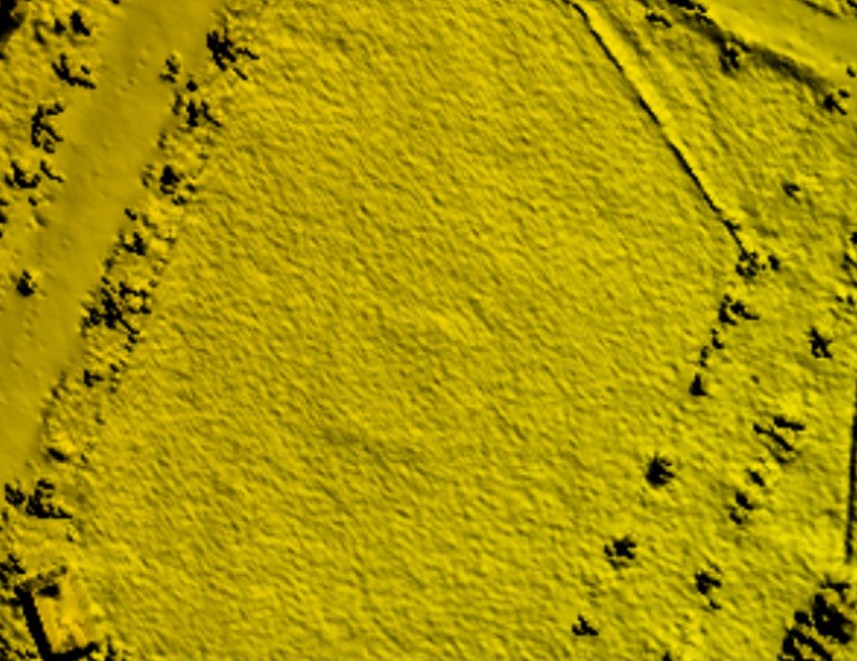
Here is an example of that simplicity. This LiDAR image is of a cricket pitch in the UK, the cricket club maintain a number of pitches used in rotation, as a whole they form a 22 yard square. This square shows very clearly in the centre of the LiDAR image below. What is not obvious to a casual observer is that the colour has no bearing whatsoever on the image, it is shaded by height alone, i.e. it is false colour. The fact the square, trees and smooth level road show up is by shading each pixel according to height and slope and nothing else.
Everyone local knows the pitch is there but suppose the height change was
caused by something else? Were you to visit the site you would see the pitches
by the way the ground staff mows them, but would you notice the change in
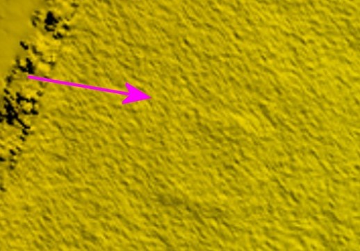
ground height as recorded on the LiDAR image? Looking at the oblique photo
below taken at shoulder height it is clear that only the most diligent and
focused observer would see it, a few inches at the most yet it is very clear
on the LiDAR.
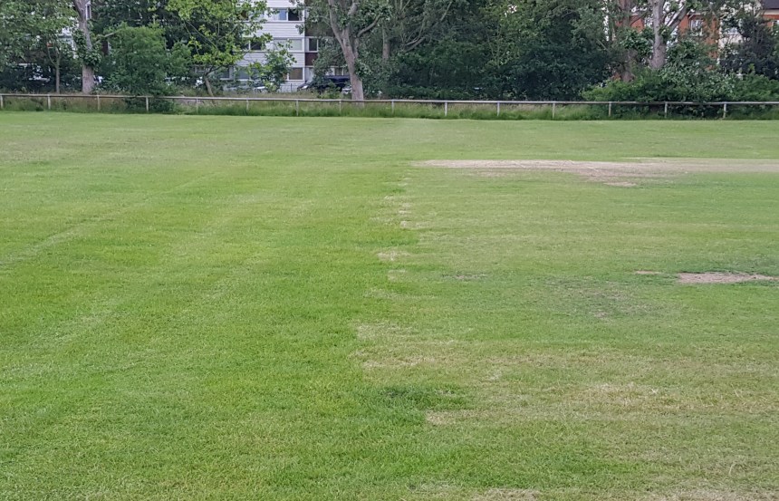
The photo was taken looking in the direction of the pink arrow. The height change does not coincide with the colour change in the grass, rather it is further left. Would anyone usually see that?
Using this simple observation can make looking for remnants of Great War activity easier especially when trench maps are georeferenced to the LiDAR image. Some easily missed ones become obvious as do some that are actually invisible on the ground.
There are many ways that LiDAR can be presented but two of the most common
are the
Digital Surface Model (DSM) which is what is shown above complete with trees
and the Digital Terrain Model (DTM).
DSM and DTM images look much the same when depicting open fields, they differ most strongly in wooded areas.
- DSM records the height of the whole surface, that includes roofs, trees, bushes etc.
- DTM images are those where this has been stripped off showing just the terrain.
Archaeologists have been able to find a wide range of sites previously hidden under the forest canopy, this hope is that by including LiDAR on this site, further discoveries will be made.
More information.
Historic England publishes a leaflet entitled Using Airborne LiDAR in Archaeological
Survey available here:-
https://historicengland.org.uk/images-books/publications/using-airborne-lidar-in-archaeological-survey/heag179-using-airborne-lidar-in-archaeological-survey/
On page 24 is an image of the Great War camp at Brocton on Cannock Chase in Staffordshire and a detailed explanation of how LiDAR can be used.
The UK government have made high resolution LiDAR available free of charge on the Defra website and the French government have followed that lead and published comprehensive high resolution images of the whole of France.
Knowledge Version 2 1.1