Knowledge Centre- Subject Index Main Help page |
French 4 figure map references
On some French trench maps, points are marked with 4 digits. See example below with those numbers in red.
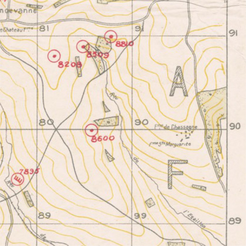
Extract from Rémonville 1/20.000 25 October 1918
These numbers are simplified map coordinates known as abbreviated hectometric
coordinates, below is an explanation using an
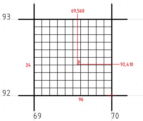
example. Suppose someone needs to mark a point "p" on the map with
coordinates longitude (x) 69,560 km and latitude (y) 92,410 km.
This point should be in the square with coordinates x 69 km and y 92 km in
the lower left corner as shown below:
 |
The procedure is as follows:
|
Point p will be marked on the map at the intersection of the lines 96 and
24:
Other points can be marked in the same square using the same system, the format
is always 9x2y in this square.
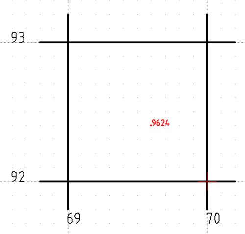
Please note that there could be several 1km squares with the same base number
on large maps.
Example: Square 69,82 would be 10km to the south of square 69,92 on the same
map. Large French maps have a letter for each 10 by 10 km area in the following
format:
The letters A and F can be seen in the example map extract. To avoid confusion
when referencing to a point the 10km square letter
should be added: Examples from that map extract should read A8208 or F7895.
Souces:
Topographie de Campagne by P.Phillipot
The U.S. Air Service In World War I Volume III by Maurer, Maurer
The story of the 27th Division by O'Ryan, John F
Knowledge Version 2 1.1