Knowledge Centre- Subject Index Main Help page |
Crop marks
Comparing georeferenced trench maps with modern aerial photography demonstrates that crop marks frequently show the location and track of Great War trenches or other features.
Features that show up well are those that had a deep effect on the soil. Trenches or blown mines were very deep so show very clearly despite being filled in, at least they do sometimes. In contrast, narrow gauge railways did not affect the soil very much so do not show up at all.
Crop marks arise from the change in growth of crops which is in turn affected by the depth of the top soil over the sub-soil and its localised drainage even if the trench or mine has been filled in.
Across the Western Front crop marks show well in some places, not at all in others and most crop marks are very transient depending on the exact stage in crop development and moisture content. Google Earth and other image providers frequently update their websites so the date the imagery was taken changes, crop marks often only show for a few weeks or even days in the growing season. This clearly affects whether crop marks show or not in an image, so changing the date of the image can be useful if the website allows that.
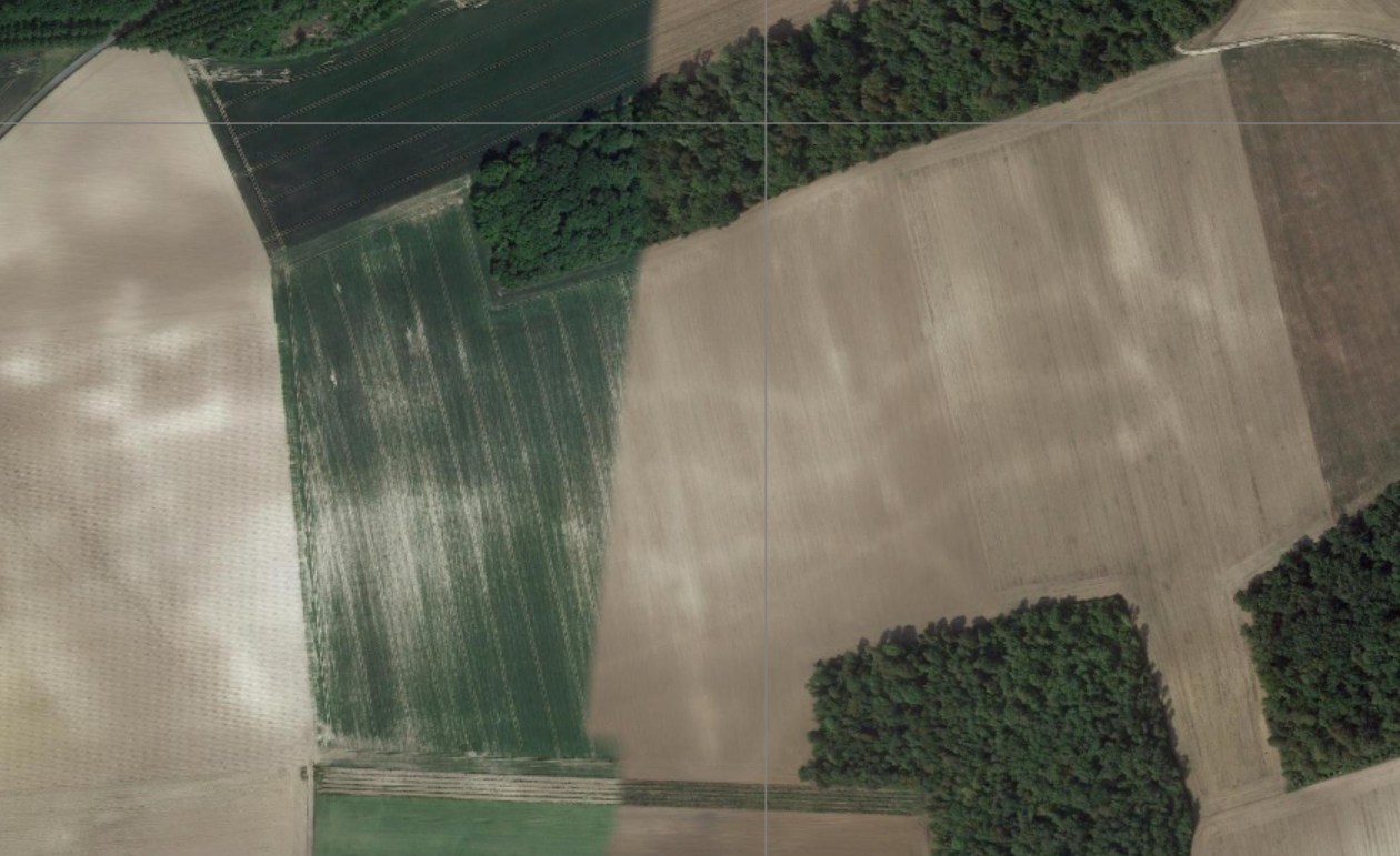
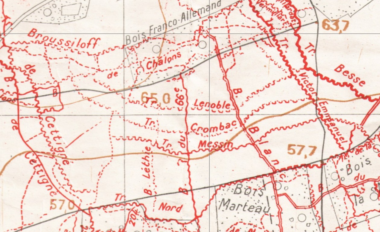
This image is the area immediately South of the Bois des Buttes where the 2nd Battalion, Devonshire Regiment fought a famous action on 27th May 1918, the first day of the Third Battle of the Aisne. It was the same day in which most of 2nd Battalion Middlesex Regiment were killed or captured nearby. Comparison with the trench map below of exactly the same area shows the trench pattern very clearly visible despite 100+ years of ploughing. Ploughing only affects the soil less than a metre in depth. Crop marks are elusive, other images of the same place show nothing at all.
French 1:10,000 map, Berry-Au-Bac N.O. Secret edition, corrected 11/04/1918. M_028070.jpg
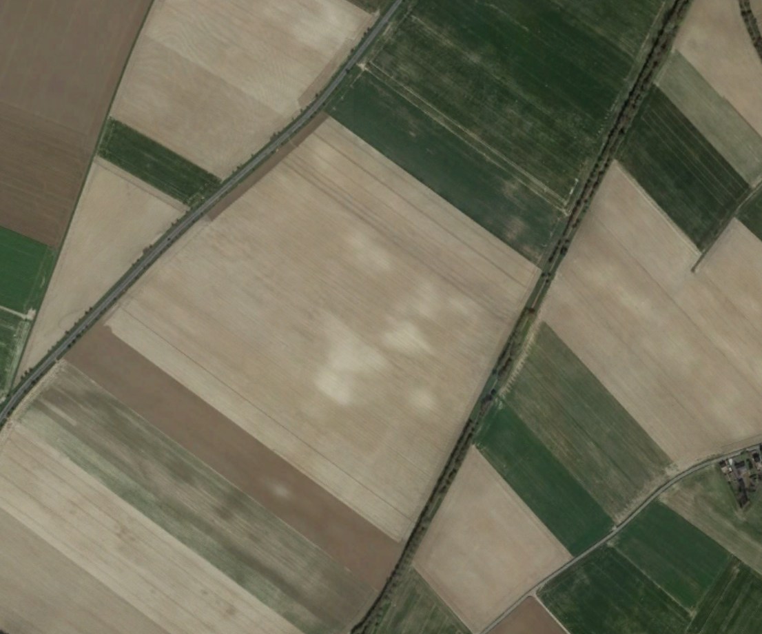
Other features that show sometimes are where a great deal of mining has taken
place such as here near Auchy-lez-La-Bassée at the Northern end of the
British front for the battle of Loos, 25th September 1915.
Historic England publishes a brief guide here but a great deal more information of relevance to the Great War is available with a simple search for crop marks in archaeology.
Knowledge Version 2 1.1